Perfect Day at CocoCay Map: Beaches, Pools & Attractions
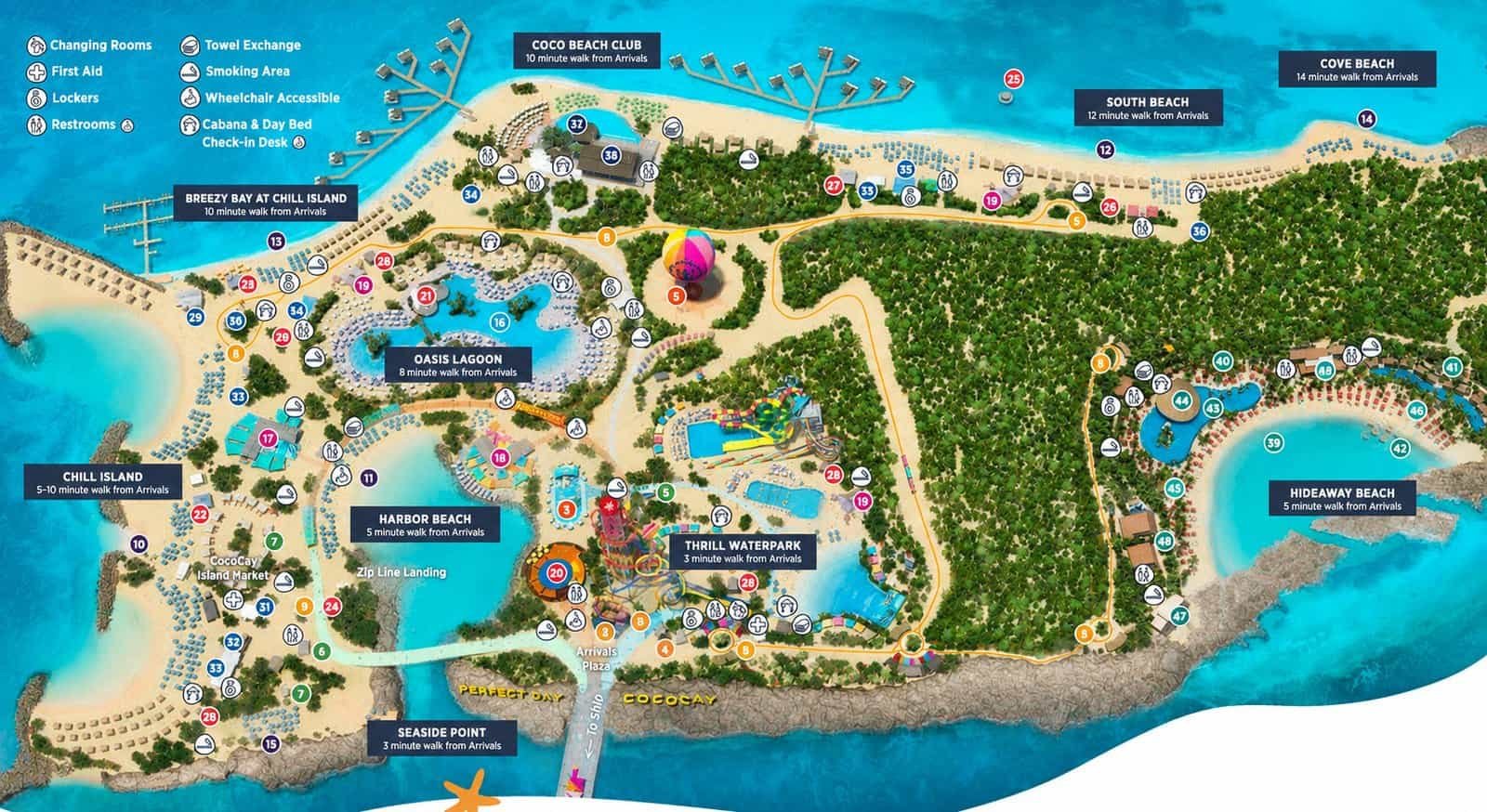
Royal Caribbean’s Perfect Day at CocoCay packs beaches, pools, water attractions, and quieter areas into a relatively compact private island. Before getting off the ship, having a map makes it much easier to understand where everything is located and how far you may need to walk.
The Perfect Day at CocoCay map below shows the island’s major areas, including Chill Island, Oasis Lagoon, Coco Beach Club, South Beach, Cove Beach, Hideaway Beach, Thrill Waterpark, Harbor Beach, Breezy Bay at Chill Island, and Seaside Point. It also provides estimated walking times from the Arrivals area to several of these destinations.
Understanding the Perfect Day at CocoCay Map
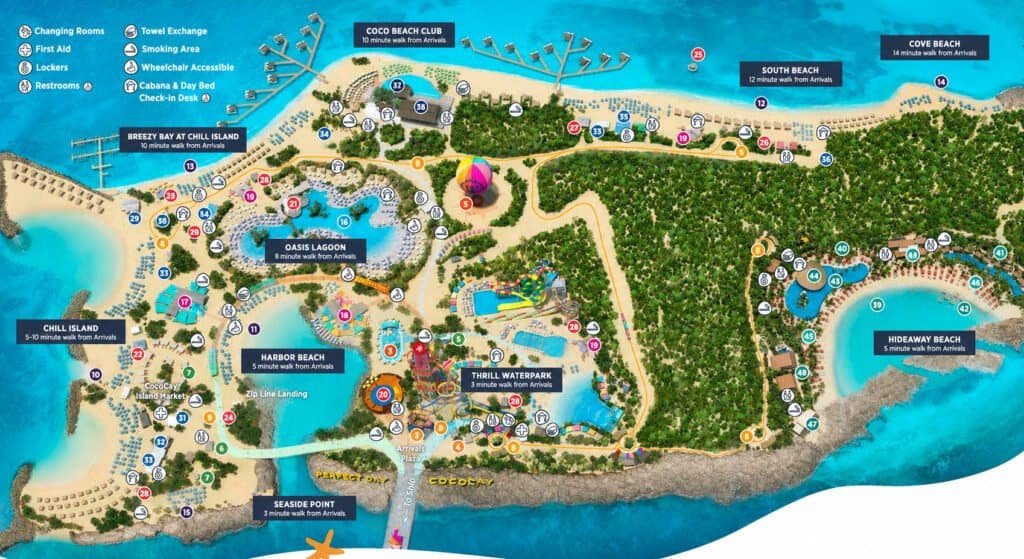
The ship arrives near the center of the developed portion of CocoCay, with the Arrivals Plaza serving as a useful reference point when looking at the map.
From there, the island essentially spreads in two directions.
Much of Chill Island, Breezy Bay, Oasis Lagoon, Harbor Beach, Coco Beach Club, and Seaside Point is located to the left of the Arrivals area on the map. Thrill Waterpark sits close to the center.
South Beach, Cove Beach, and Hideaway Beach are located farther to the right.
The map also marks pathways connecting the different sections, making it useful for planning a day that involves more than one area.
Beaches at Perfect Day at CocoCay
There are several distinct beach areas shown on the CocoCay map.
Chill Island occupies a large portion of the western side of the island. Within this general area, the map also identifies Breezy Bay at Chill Island.
Harbor Beach is considerably closer to the Arrivals area and sits beside the central attractions.
Farther north is Coco Beach Club, while South Beach and Cove Beach stretch along the opposite side of the island.
Hideaway Beach occupies its own large area on the eastern side of CocoCay.
Because these areas are spread across the island, deciding where you want to spend most of your day before arriving can reduce unnecessary walking.
Walking Times From the Arrivals Area
One particularly useful feature of this Perfect Day at CocoCay map is the inclusion of approximate walking times from Arrivals.
The map lists:
- Thrill Waterpark – 3 minutes
- Seaside Point – 3 minutes
- Harbor Beach – 5 minutes
- Hideaway Beach – 5 minutes
- Chill Island – 5–10 minutes
- Oasis Lagoon – 8 minutes
- Breezy Bay at Chill Island – 10 minutes
- Coco Beach Club – 10 minutes
- South Beach – 12 minutes
- Cove Beach – 14 minutes
These estimates give cruisers a much better idea of the island’s scale. Even destinations that appear fairly distant on the map are generally shown as being within a relatively short walk of Arrivals.
Oasis Lagoon
Oasis Lagoon is easy to spot on the map because of its large pool area near Chill Island.
Its central location also puts it within reach of several other parts of CocoCay. The map places Oasis Lagoon approximately eight minutes on foot from Arrivals.
For guests planning to move between the pool and beach areas during the day, the map helps show how Oasis Lagoon connects with the surrounding sections of the island.
Thrill Waterpark
Thrill Waterpark is one of the closest major areas to the Arrivals Plaza, with the map indicating an approximately three-minute walk.
The waterpark occupies a sizable central section of CocoCay and is clearly separated from the surrounding beach and pool areas.
Its location makes it easy to identify on the map and provides a useful landmark when getting oriented after arriving on the island.
Hideaway Beach
Hideaway Beach occupies a large section on the eastern side of CocoCay.
Despite appearing relatively far from several of the island’s western beaches, the map lists Hideaway Beach as only about a five-minute walk from Arrivals.
The area includes its own lagoon-style waterfront section and is separated geographically from the island’s main Chill Island and Oasis Lagoon areas.
Coco Beach Club, South Beach and Cove Beach
The northern coastline contains several additional beach areas.
Coco Beach Club is listed as approximately a 10-minute walk from Arrivals. Moving east across the map, South Beach is listed at approximately 12 minutes, while Cove Beach is the farthest of the labeled beach areas at approximately 14 minutes.
Looking at these locations together is particularly useful if you are deciding which section of CocoCay you want to visit first.
Accessibility and Guest Facilities
The CocoCay map also identifies numerous facilities throughout the island.
Symbols indicate locations for changing rooms, towel exchanges, first aid, lockers, smoking areas, restrooms, wheelchair-accessible facilities, and cabana and day-bed check-in desks.
Rather than having all of these facilities concentrated near the entrance, the map shows many of them distributed throughout the major beach, pool, and attraction areas.
Using the Map to Plan Your CocoCay Day
The biggest advantage of looking at the Perfect Day at CocoCay map before your cruise is simply understanding how the different areas relate to one another.
If you already know that you want to spend most of your day at Chill Island, South Beach, Oasis Lagoon, or another specific area, you can see its location relative to Arrivals before stepping off the ship.
The map is also helpful for anyone planning to visit multiple areas. For example, Oasis Lagoon, Harbor Beach, Chill Island, and Thrill Waterpark are clustered relatively close together, while South Beach, Cove Beach, and Hideaway Beach occupy the opposite side of the island.
That makes the map useful not only for finding individual attractions, but also for deciding how you want to structure your day ashore.
Perfect Day at CocoCay Map FAQ
How long does it take to walk around CocoCay?
Walking time depends on your destination. According to the map, several major areas are within 3–10 minutes of Arrivals, while Cove Beach is listed at approximately 14 minutes.
How far is Chill Island from the ship?
The map lists Chill Island as approximately a 5–10 minute walk from Arrivals.
How far is Oasis Lagoon from Arrivals?
Oasis Lagoon is shown as approximately an eight-minute walk from Arrivals.
How far is Thrill Waterpark from Arrivals?
The map lists Thrill Waterpark as approximately a three-minute walk from Arrivals.
Where is Hideaway Beach on CocoCay?
Hideaway Beach is located on the eastern side of the island on the map. It is listed as approximately a five-minute walk from Arrivals.
Which CocoCay beach is farthest from Arrivals on this map?
Of the beach areas with a specific walking time shown, Cove Beach has the longest listed walk at approximately 14 minutes from Arrivals.
Does the CocoCay map show restrooms and other facilities?
Yes. The map uses symbols to identify restrooms, changing rooms, towel exchanges, lockers, first aid, smoking areas, wheelchair-accessible facilities, and cabana and day-bed check-in desks.

Conclusion
Perfect Day at CocoCay has several distinct beach, pool, and attraction areas, and seeing their locations before your cruise can make planning the day much easier.
The Perfect Day at CocoCay map provides a useful overview of Chill Island, Oasis Lagoon, Thrill Waterpark, Coco Beach Club, South Beach, Hideaway Beach, Cove Beach, Harbor Beach, and the island’s other major areas. The included walking-time estimates are particularly helpful for understanding how close each area is to Arrivals.
Whether you plan to spend the entire day in one spot or explore several parts of CocoCay, saving the map before your cruise gives you a useful reference for deciding where to go once you arrive.